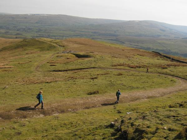
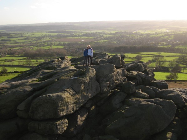
Enjoying the summit plateau of Adleborough – a true poison dwarf
The Stats
Mountain: Adldebrough, near Askrigg
Height: 476m
Distance: 7 1/4 miles
Time taken: 5 1/4 hours
The Review
At this point he could barely hear each other over the sound of the torrential, apocalyptic rain and I had left Dad stranded on a rock in the middle of the river Ure.
After the great heroics of last week a calm, fairly relaxing is what we were hoping for today. And in some respects, we got that – an open, pleasant ascent up to a beautifully peaceful mountain watchtower over sunny, glittering Wesleydale. It was only with around a mile to go when the tables turned…
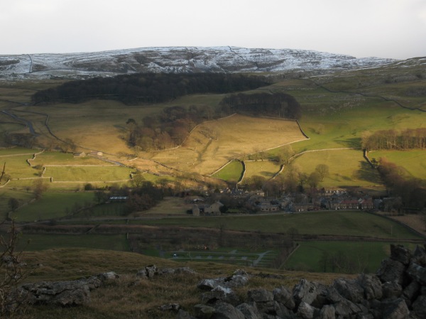
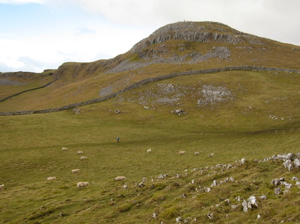
We parked up in the serene, quiet village of Worton and ascended gradually but persistently soon to find ourselves stopping regularly to admire in awe at the ever-broadening views. The first part of the walk was over open moorland but nonetheless offered necessary preparation for what was soon to come. Looking ahead on our map the point beneath the great bulk of the mountain was “where the fun starts”. In other words this was where the tracks end and the off-piste, free walking begins.

Having lunch on the plateau after a strenuous climb up
Except to our surprise and perhaps slight dismay, the small path (or, to use the technical term, “trod”) lead us clearly up the eastern flank of the mountain. The climb was tiring and relentless but we were soon tucking into our sandwiches on an arty summit shelter. Now we were free to roam and explore the plateau. We made our way to the summit cairn first, on the other side of the mountain. The descent we knew was going to be difficult as we knew there wasn’t going to be a bridleway for another kilometre or so. Also the flatlands that we could see clearly beneath us were criss-crossed with stone walls meaning that we had to plan our route carefully to avoid any awkward wall-climbing.
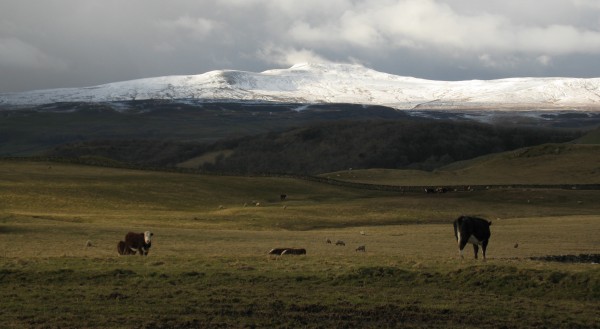
Anyway, we were up there so we soaked up the endless views. The sunshine seeked out little areas of land to highlight in bright lights, perfect for photography. We could also see clearly into the valley of Raydale to see Seamer Water and Wether Fell, the route which was another surprise classic back in April.

The beautiful view into Raydale. The top of Wether Fell can just about be seen to the left of Seamer Water
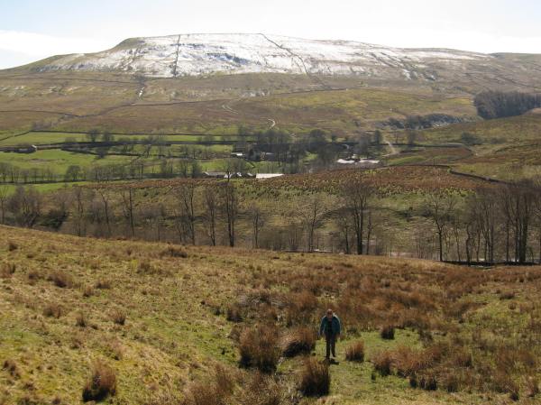
After a great deal of discussion over which route to take off the mountain, Dad surprised me by trusting in my route and not continuing to fraternise further on the summit. So, we made our way off the steep side of Addlebrough and got a good view of the craggier, meaner side of the mountain before it disappeared under the horizon. Despite difficult navigation around very long grass my route seemed to work well and before we knew it we were back on a perfectly clear bridleway.
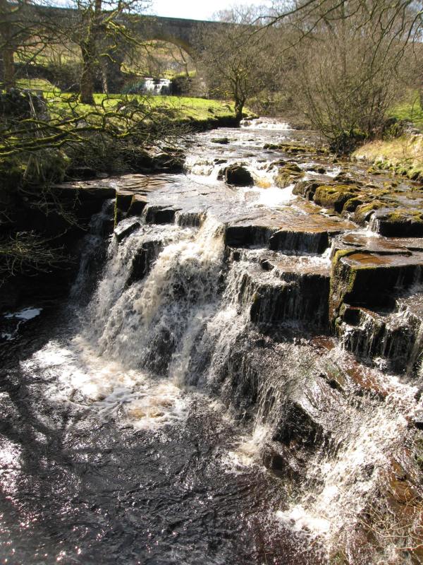
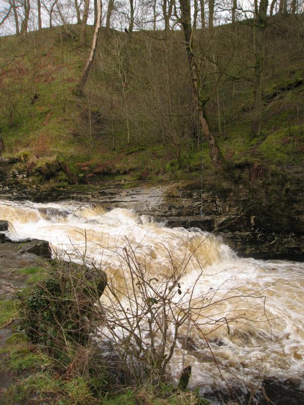
Our plan from here on was to ignore the guidebook instructions and head by the river on the disused railway line. Bad idea. The route was scenic and amiable, yes but the prospect of stepping stones at the end was mentioned. “They’re always a bit dubious. You never quite know what’ll be there,” Dad told me on the approach to the stones and my apprehension didn’t ease.
Some clever map skills from Dad lead us back to right side of the river and we were hoping that we’d be able to make our way back to the car before a rainstorm arrived. Indeed, to our right was a mass of grey cloud that looked worryingly angry and unstoppable. Finally, we found the stepping stones but we’d immediately noticed that the river was still a good ten metres wide.

The stepping stones from hell…
A total of twenty stones stood in our way – and they were slippy. The picture you can see above was just before the sky above became grey, dark and menacing. I got nervous before Dad did and he volunteered to go first. It had been raining heavily for two minutes or so and the stones seemed to be getting slippier and slippier. Dad was one stone ahead of me. He stepped tentatively onto a stone further and precariously nearly slipped over completely. Not wanting to stay in a danger zone he moved quickly and made the big step onto the next stone further.
I had seen the near fall from Dad wished not to test my luck so turned back. At this point he could barely hear each other over the sound of the torrential, apocalyptic rain and I had left Dad stranded on a rock in the middle of the river Ure. I was running back and forwards not sure whether to wade through a smaller crossing in the river or not. My mind was made up when I realised there was no other option.
“I’m gonna go for it, Dad,” I shouted but Dad was still trying desperately to turn around and pass the slippy rock again without falling. I was soon in the middle of the river, trying carefully not to slip over a smooth, huge rock. I reached the other side by the time Dad had got off the stepping stones. I sat there emptying the pools of water out of my shoes whilst Dad reluctantly walked across.

Walking through on of the tropical forests of Thornton Rust
The rain finally stopped and we changed our socks. Dad’s mood didn’t lighten as we soaked our legs further through a thigh deep “jungle”. Hoards of nettles waited for us on the narrow, steep, walled track ahead and our legs were soon sodden, stung and covered in tiny seeds.
At last we found refuge in the car and changed our shoes ready for a relaxing journey home. A step too far – well, for Dad at least…
 The Stats