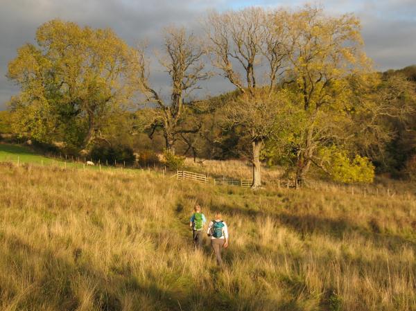
Walking through fields near the derelict church of St. Mary
The Stats:
Area: Greta Bridge, County Durham
Distance: 10 miles
Time taken: 5.5 hours
The Review:
Delicate, parched leaves patted gently on the damp ground as we plodded up the road near Greta Bridge. The idea was to enjoy a short, easy and simple walk through woodland that, despite lacking in variety, would provide a great place to enjoy the fresh air and nature at its loveliest. Yet it soon became apparent to us fairly early on in the walk that our visions of an ideal day out were far from the laborious reality. There we were, blasting through the nettles and thorns like angry elephants, not knowing whether we were on track – or even going in the right direction! The air was thick and moist and the forest so dense it could have easily been perceived as some sort of tame English jungle (had we not been 5 minutes off the A66 west of Darlington). Despite starting almost right by the motorway, it didn’t take long to become encapsulated in a forest that’s noise could rival that of a busy highway (and that’s not mentioning Dad’s ranting and raving!)
The noise was mostly coming from the fast-flowing River Greta, which we were following up and down between the village of Greta Bridge and Bignall Mill. I know what you’re thinking: you’ve seen the title and you’re thinking ‘how could they get lost here? They’re following a river!’ Well, kind reader, let me assure you that not all the route was directly beside the river and we got lost but not through our own fault. We blame it on the guide book writer! Stay with me – here’s the story:
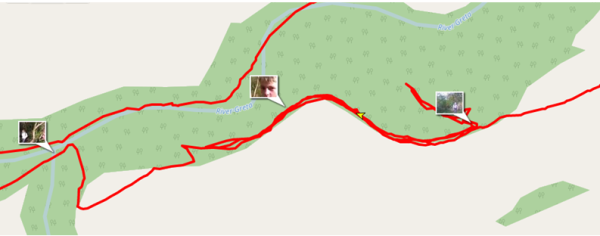
The important section of the map (aka where it all went wrong)
Following the so far adequate instructions, we left the road and entered the woods. We’d been advised to stick to the inner edge of the woods, an instruction that would be bellowed out to the group many times later on by a stressful Dad hoping that there’d be some sort of hidden solution. The complication occurred when the ‘path leading down to the river’ was never found. Soon after entering the woods, we came to a junction of paths, with one leading down into the woods and another continuing straight ahead. Correctly, we decided to continue straight ahead, concluding that we hadn’t walked far enough to reach the point on the map at which the path turned down towards the river. Already we were complaining about the poor signage and instructions which was soon to become a theme of our day.
So, as you can see on the map above, we continued on the inner edge of the woods, round a corner. The first fatal error came when Dad thought that at that bend we should start heading down to the tributary (actually, it was the next bend that we were looking for). Stumped, we turned back, hoping that the previous path we’d bypassed was actually the right one. By this point we had confirmed that the writer of the book we were using hadn’t actually walked the route recently, but rather was giving us directions from a map, which we could easily have done ourselves. As you can see on the map, we turned back and after rather optimistically trying another offshoot of this path and failing, we were close to giving up. Feeling rather defeated, we sat at the junction of paths and had lunch.
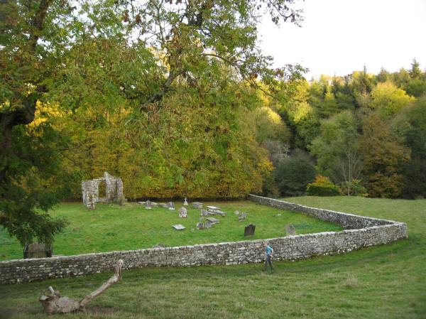
Later on in the walk – passing St. Mary’s Church
It was at this point that we called for help from Polly, my sister who was back at base camp (home). She could send us a picture of a detailed OS map (ours was only in the substandard guide book, of which by this point had been completely trashed, but not thrown away, by the group) and also a map showing where we were in the area. This helped enormously, and soon we were confidently strutting off west, in the direction we first started. We tried carrying on as far as we could, but as before, the path disintegrated rapidly. Needing just to find a viable route where we wouldn’t get our trousers ripped to shreds, we stuck very close to the barbed wire fence. Then came another obstacle. A second barbed wire fence stopped us from continuing in the same direction, so our only option was to climb over a safe section of fence onto a neighbouring field. There was a small plantation to our left, so we were forced to walk along the edge of the field to the next point at which we could reach the forest. A wit’s end, Dad said that we’d have to do some burrowing and then turn back. Indeed, some serious burrowing followed and we realised we were surprisingly close to the river. Ahead of us was a fairly steep decline, with the river visible at the bottom. Knowing that the path was running along the river, we gingerly headed down, and soon found to great relief and surprise the path, running diagonally down the hill.
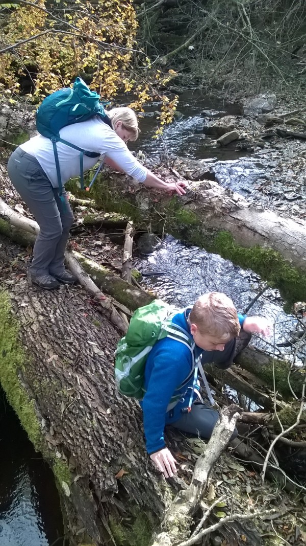
Crossing “nature’s bridge”
We hoped that the rest off the walk would be plain sailing and that we could get going to make up lost time. Navigation wasn’t so easy over ‘nature’s bridge’ on a small tributary that lead to the River Greta. Mum was soon entangled in branches and upturned roots as we tried to cross a fallen tree trunks. The stepping stones mentioned in the now completely abandoned book seemed non existent. The path from then on was difficult – undulating and slippy, it meant for a much more tiring walk than billed, and that’s not including the two miles we spent trying to find a way down to the river. Every so often a pheasant would startle you and explode into a frenetic combination of flaps and squawks, reminding you that you’re not really in the jungle.
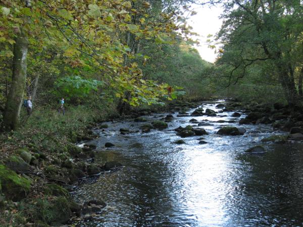
Walking along the treacherous riverside path
We soon reached Bignall Mill, the point at which we’d cross the river and turn back on the other side. After a bit more tedious route finding we made our way to the derelict Church of St. Mary. The golden sunlight made the scene feel all the more evocative as we briefly rested. We soon continued in more fields of gold, ducking down into the jungle every so often and then coming back up for air. After spending most of the day in the depths of the gorge, being in the open fields felt like you were free again, and it was comforting to see that you were no longer engulfed in trees.
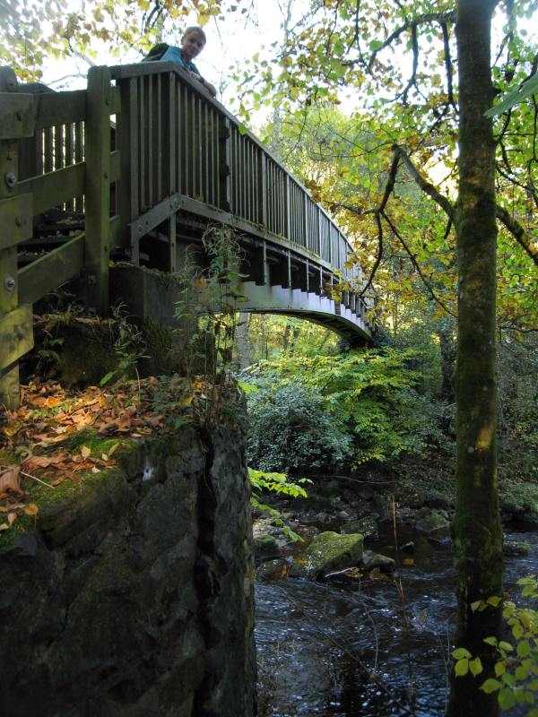
The bridge at Bignall Mill
Considering the walk’s length, we soon ended up at the car at sunset. Altogether, another semi-successful day out was done, complete with stress, humidity and a whole lot of heroic (or perhaps just tiresome) off-piste walking. What more could you ask for?


