A Halloween Nightmare – “The Greta Walk”

img_9912

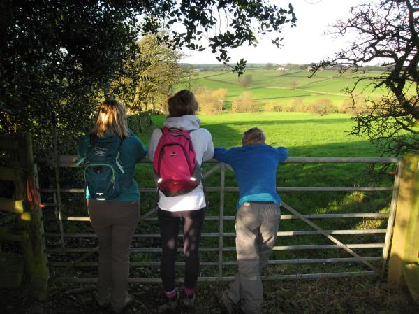
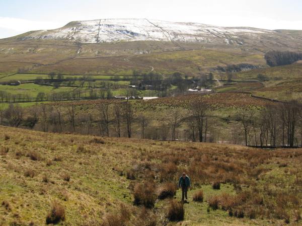
Walking through fields near the derelict church of St. Mary

The Stats:

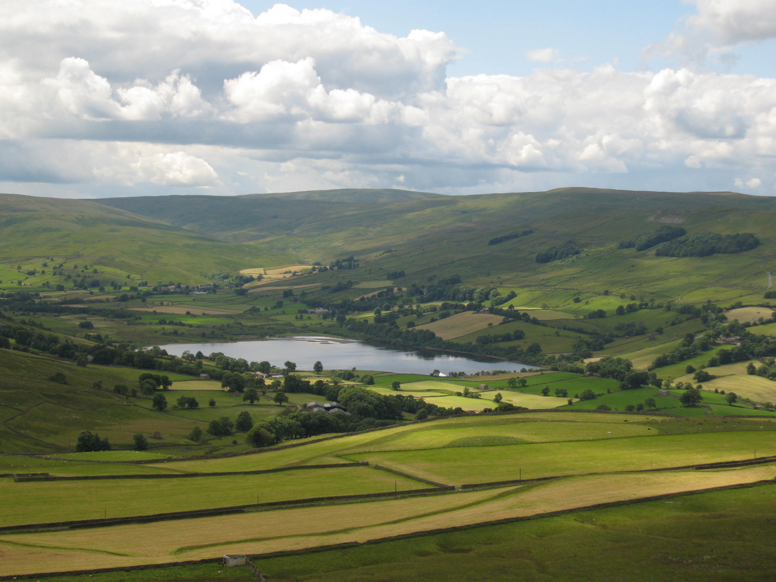
Area: Greta Bridge, County Durham

Distance: 10 miles

Time taken: 5.5 hours

The Review:

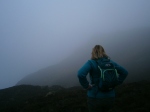
Delicate, parched leaves patted gently on the damp ground as we plodded up the road near Greta Bridge. The idea was to enjoy a short, easy and simple walk through woodland that, despite lacking in variety, would provide a great place to enjoy the fresh air and nature at its loveliest. Yet it soon became apparent to us fairly early on in the walk that our visions of an ideal day out were far from the laborious reality. There we were, blasting through the nettles and thorns like angry elephants, not knowing whether we were on track – or even going in the right direction! The air was thick and moist and the forest so dense it could have easily been perceived as some sort of tame English jungle (had we not been 5 minutes off the A66 west of Darlington). Despite starting almost right by the motorway, it didn’t take long to become encapsulated in a forest that’s noise could rival that of a busy highway (and that’s not mentioning Dad’s ranting and raving!)

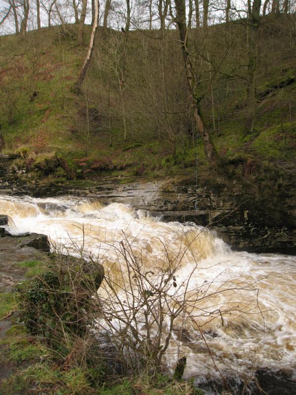
The noise was mostly coming from the fast-flowing River Greta, which we were following up and down between the village of Greta Bridge and Bignall Mill. I know what you’re thinking: you’ve seen the title and you’re thinking ‘how could they get lost here? They’re following a river!’ Well, kind reader, let me assure you that not all the route was directly beside the river and we got lost but not through our own fault. We blame it on the guide book writer! Stay with me – here’s the story:

lost3

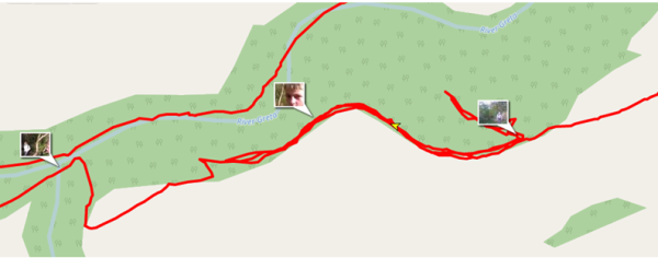
The important section of the map (aka where it all went wrong)

Following the so far adequate instructions, we left the road and entered the woods. We’d been advised to stick to the inner edge of the woods, an instruction that would be bellowed out to the group many times later on by a stressful Dad hoping that there’d be some sort of hidden solution. The complication occurred when the ‘path leading down to the river’ was never found. Soon after entering the woods, we came to a junction of paths, with one leading down into the woods and another continuing straight ahead. Correctly, we decided to continue straight ahead, concluding that we hadn’t walked far enough to reach the point on the map at which the path turned down towards the river. Already we were complaining about the poor signage and instructions which was soon to become a theme of our day.

So, as you can see on the map above, we continued on the inner edge of the woods, round a corner. The first fatal error came when Dad thought that at that bend we should start heading down to the tributary (actually, it was the next bend that we were looking for). Stumped, we turned back, hoping that the previous path we’d bypassed was actually the right one. By this point we had confirmed that the writer of the book we were using hadn’t actually walked the route recently, but rather was giving us directions from a map, which we could easily have done ourselves. As you can see on the map, we turned back and after rather optimistically trying another offshoot of this path and failing, we were close to giving up. Feeling rather defeated, we sat at the junction of paths and had lunch.

img_9914

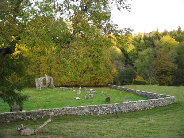
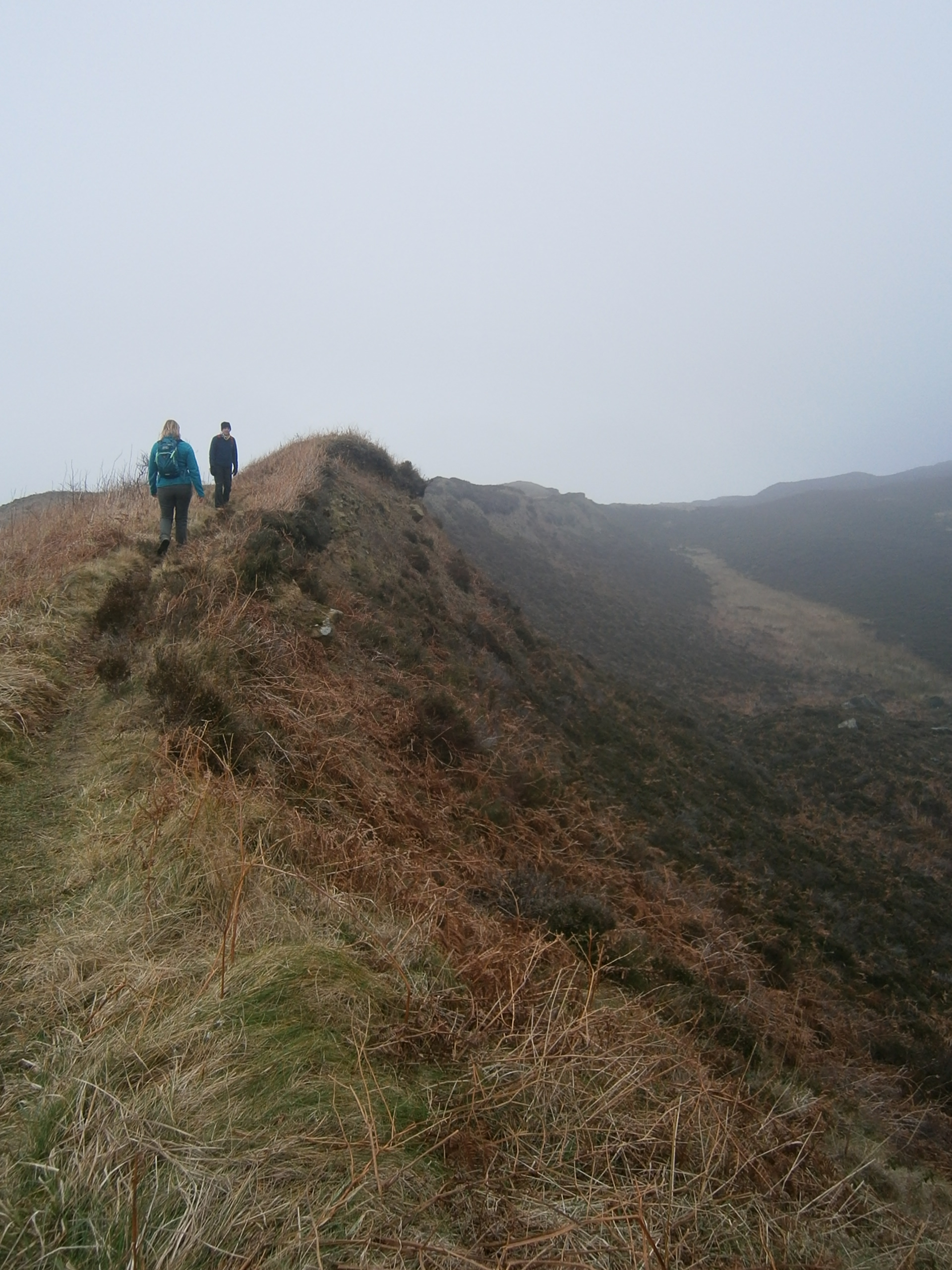
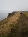
Later on in the walk – passing St. Mary’s Church

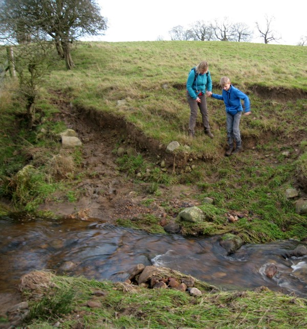
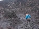
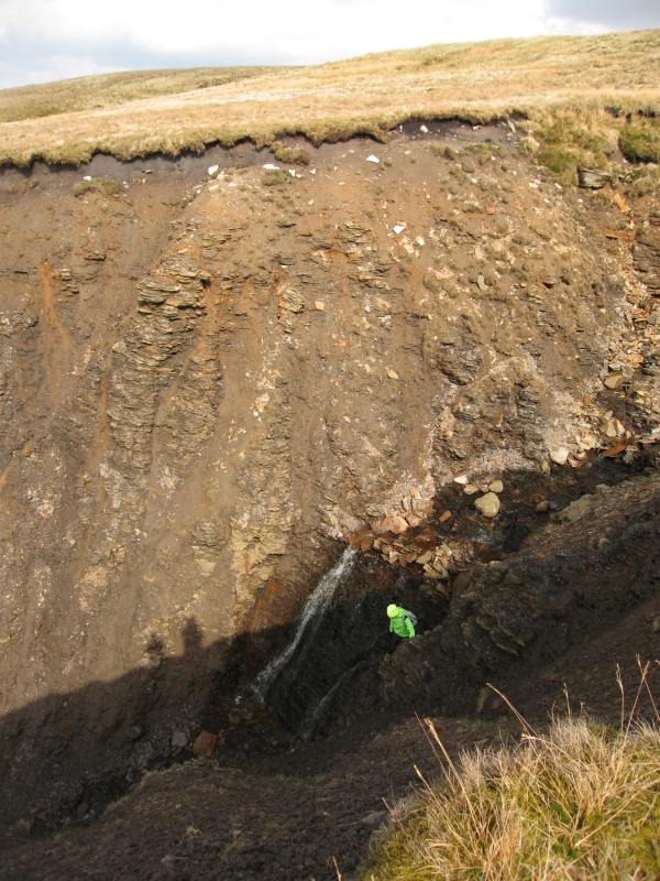
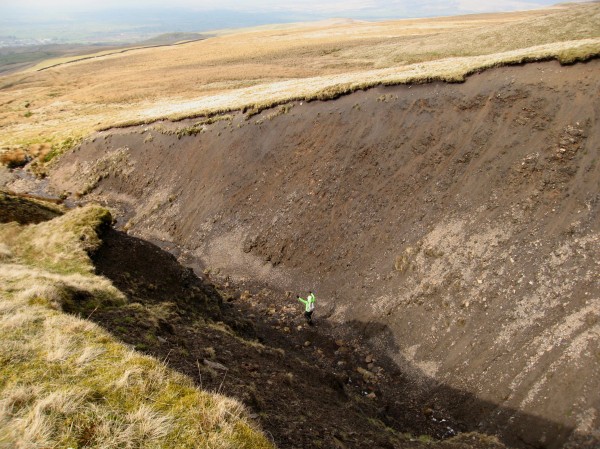
It was at this point that we called for help from Polly, my sister who was back at base camp (home). She could send us a picture of a detailed OS map (ours was only in the substandard guide book, of which by this point had been completely trashed, but not thrown away, by the group) and also a map showing where we were in the area. This helped enormously, and soon we were confidently strutting off west, in the direction we first started. We tried carrying on as far as we could, but as before, the path disintegrated rapidly. Needing just to find a viable route where we wouldn’t get our trousers ripped to shreds, we stuck very close to the barbed wire fence. Then came another obstacle. A second barbed wire fence stopped us from continuing in the same direction, so our only option was to climb over a safe section of fence onto a neighbouring field. There was a small plantation to our left, so we were forced to walk along the edge of the field to the next point at which we could reach the forest. A wit’s end, Dad said that we’d have to do some burrowing and then turn back. Indeed, some serious burrowing followed and we realised we were surprisingly close to the river. Ahead of us was a fairly steep decline, with the river visible at the bottom. Knowing that the path was running along the river, we gingerly headed down, and soon found to great relief and surprise the path, running diagonally down the hill.

wp_20161029_008

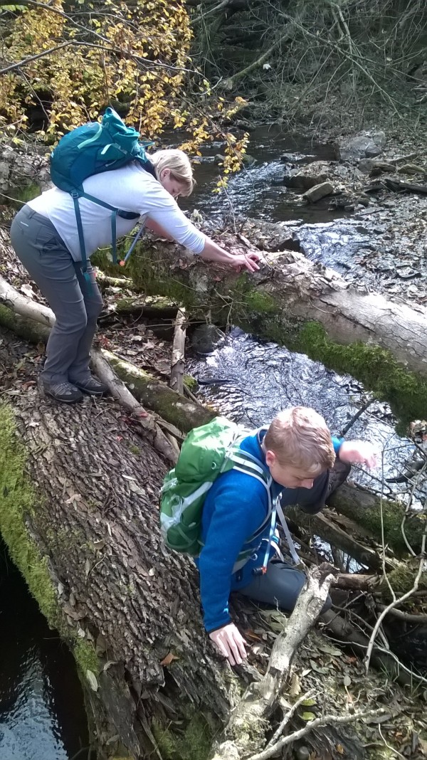
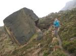
Crossing “nature’s bridge”

We hoped that the rest off the walk would be plain sailing and that we could get going to make up lost time. Navigation wasn’t so easy over ‘nature’s bridge’ on a small tributary that lead to the River Greta. Mum was soon entangled in branches and upturned roots as we tried to cross a fallen tree trunks. The stepping stones mentioned in the now completely abandoned book seemed non existent. The path from then on was difficult – undulating and slippy, it meant for a much more tiring walk than billed, and that’s not including the two miles we spent trying to find a way down to the river. Every so often a pheasant would startle you and explode into a frenetic combination of flaps and squawks, reminding you that you’re not really in the jungle.

img_9905

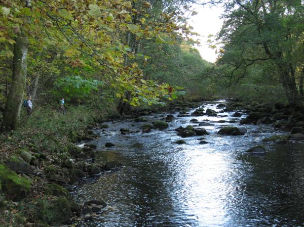
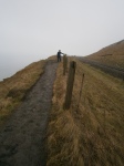
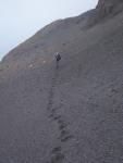
Walking along the treacherous riverside path

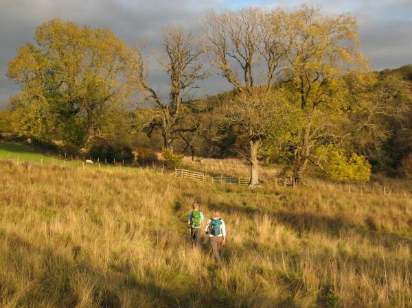
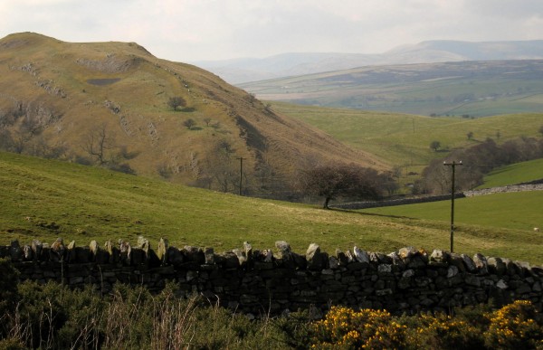
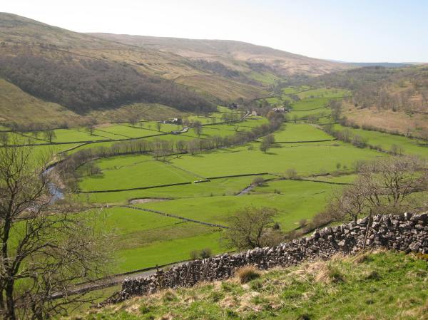
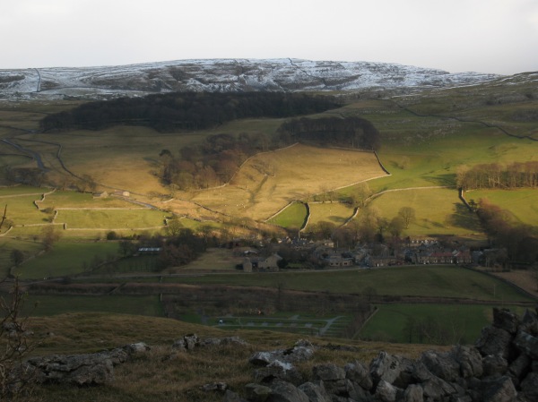
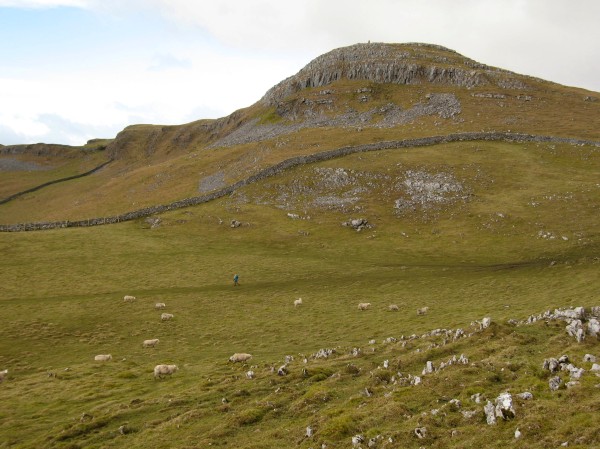
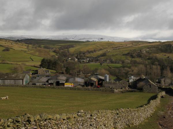
We soon reached Bignall Mill, the point at which we’d cross the river and turn back on the other side. After a bit more tedious route finding we made our way to the derelict Church of St. Mary. The golden sunlight made the scene feel all the more evocative as we briefly rested. We soon continued in more fields of gold, ducking down into the jungle every so often and then coming back up for air. After spending most of the day in the depths of the gorge, being in the open fields felt like you were free again, and it was comforting to see that you were no longer engulfed in trees.

img_9906

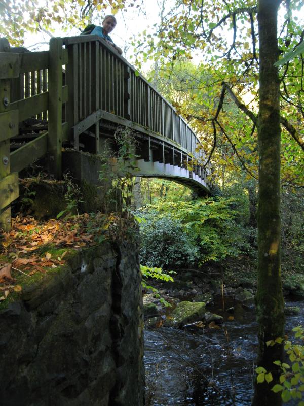
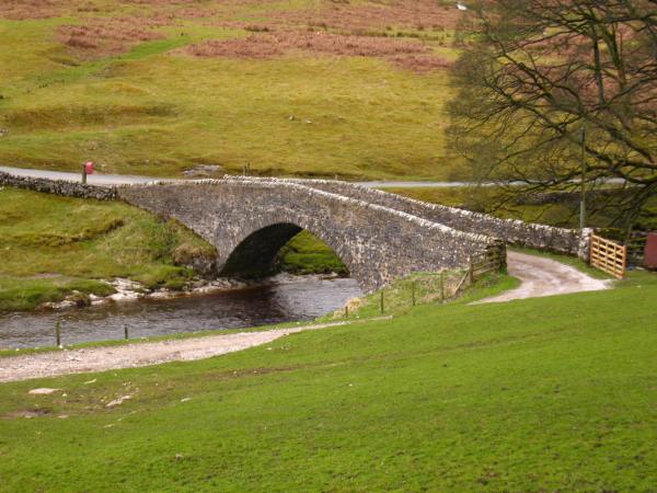
The bridge at Bignall Mill

Considering the walk’s length, we soon ended up at the car at sunset. Altogether, another semi-successful day out was done, complete with stress, humidity and a whole lot of heroic (or perhaps just tiresome) off-piste walking. What more could you ask for?

The Forgotten Dale – Cotterdale

IMG_8829

Reunited, walking down to Appersett


The Stats:

Area: Wensleydale

Distance: 8.5 miles

Time taken: 4.5 hours

The Review:

Cotterdale is a largely unheard of offshoot of the famous Wensleydale. Even Dad hadn’t heard about it because it is located between two different Ordinance Survey maps, making it difficult to spot when planning. Cotterdale was the target and main attraction of today’s walk, which headed out along the river to Thwaite and Cotterdale itself, and returned by a long broad hill to the start point of Appersett.

IMG_8814

Looking back at the start of the route


So, after a long but not too long drive we headed out of Appersett west, along the Rive Ure. The first part of the route was straight forward and flat, so we were soon at the hamlet of Thwaite ready to head north for Cotterdale and beyond. The first part of the route was pleasant and the walk had been very enjoyable. At the end  this straight was Thwaite where we found an owl looking at us through a barn window, although it flew out of view just as Mum turned the corner and Dad brought out his camera. There was also a surprise falls that we hadn’t previously spotted on the map. We had lunch under Thwaite Bridge where we all sat in different places along the riverbank (because… well, I don’t know.)

IMG_8809

The surprise waterfalls


When we reached the brow of the hill we headed down though a plantation on some very slippery and boggy slopes. Dad took a tumble and went ankle deep before we arrived in the beautiful village of Cotterdale. It was small, quaint and quiet but Mum and Polly (yes, Polly went on this walk for the first time in a long time) wanted to keep walking whilst me and Dad stayed behind in the village. This of course meant that they took the wrong route and we were separated for about an hour before the girls found the correct route and caught up with us. We expected them to continue along the low route and end up in Appersett to meet up with us. We found each other anyway, and the walk continued as planned.

IMG_8819

Confusing directions towards Cotterdale


The route we thought we were going on was 7.5 miles but Dad had extended it without realising so it ended up being 8.5 miles. This made the final mile a difficult one, and at least Dad and I were exhausted when we reached the car. Strangely, the girls didn’t seem too fatigued, even though they had done a slightly longer route.

A short but agonising road walk to the car concluded a great day out. It wasn’t too eventful, for once, and I was thankful for that.

Bog Standard – Nine Standards Rigg

IMG_8789

Jumping in the peat bogs with Nine Standards Rigg in the background

The Stats:

Area: Kirby Stephen and Hartley

Distance: 9.5 miles

Time taken: 5 hours

The Review:

The previous two Easter walks with my friend Guy have been huge successes. Arguably the greatest of them all was Buckden Pike, a splendid walk on a splendid day. Wether Fell, last year’s walk, wasn’t bad either, with great weather and a surprisingly good summit. So today’s walk, Nine Standards Rigg had a lot to live up to. However, our expectations weren’t high. As seen from a quick Google, Hartley Fell (which is the hill the Nine Standards Rigg sits on) looks like any other bleak moorland. The Nine Standards themselves are no more than nine stone pillars. The back story is moderately interesting (Wainwright once said they could have been built to make Scottish invaders think there was an English camp on the hill. Actually, it was probably built to mark the Yorkshire-Cumbria), but not enough to merit its bleak surroundings. So we came with low expectations, although that may not have been a bad thing.

IMG_8769

The suspended fence

You see, if you come with low expectations, any moderately good section of a walk is made even better. However, the first part of the route in any view was more than “moderately good”. Obviously, this was the bit when we weren’t climbing the Rigg. Instead we wondered from Hartley over fields and into a little wood, following a treacherous and winding path. We started the walk by marvelling at the legendary “suspended fence”. As we would also see later on in the walk, there had been many landslips in the area over the last month. This was made clear to us by the way a fence was partially suspended in the air after the land had slipped away beneath it. The whole length of the fence looked unmoved and untouched, as if it had been built after the landslip had occurred. It was bizarre, and certainly made us chuckle.

IMG_8770

The “waterfall”

Later landslips proved a problem when we got into the trees. They had caused path erosion and fallen down trees, yet none of such obstacles stopped us from continuing with the walk, even when a sign said that the path was closed. We continued along the increasingly slippery path to find a “waterfall” as described in the instructions. I write “waterfall” in speech marks because it seemed more like a waterslide, or, as Dad eloquently described it: “its a waterfall that thinks its a conveyer belt.”

IMG_8780

The last approach up to the Rigg

After the woods, we faced a mountain and a decision. We could either “scramble” (more misdirecting vocabulary from the guidebook. It was more like a steep plod) up a grassy, barely-worth-mentioning hill, or walk around the hill. The clear choice was the latter, and we were glad of our route, because we later found out that the unworthy hill that we saw was just a foothill of a different, impressive but nasty-looking hill (or should I say mountain).

IMG_8787

Four pillars on Hartley Fell

We walked all the way around the hill to Ladthwaite Farm. From there, we walked up to the base of the great Hartley Fell. Upon first sighting of Nine Standards, it looked miles away. It had felt like we’d made good progress, but we’d only walked 3 1/2 miles and it didn’t look like we were going to reach the Rigg anytime soon. We headed up the coast the coast, directly towards the stones. The peat bog wasn’t as bad as we were expecting and, although it got worse at the very end, we finally arrived at the Rigg. There we had lunch and admired the views. The weather for more or less the entire day was much better than we were expecting, which made the walk all the more enjoyable. The views were expansive but not spectacular, which was pretty much what we were expecting. We walked along the brow of the hill towards the trig point, and after jumping up and down in the mud we made the long way back down.

IMG_8796

The moment before Guy makes his move down the waterfall

IMG_8797

He survives, somehow

The descent of Hartley Fell was much more difficult than the ascent. It was manageably boggy but the main problem with the bogs is that they made the route difficult to find. We eventually found ourselves going off-piste, which was OK because we knew we’d intersect the main track eventually.

Actually, it may have been a blessing in disguise. We cut off a corner of the main route and Guy successfully scrambled down a waterfall (a real one this time) in a gulley. We eventually reached the path and got back on track.

IMG_8773

A view of the hill we almost climbed on the way down from Hartley Fell

The final part of the walk was a 2 mile walk along the road. Although this was boring, it meant that we could get going without having to worry about navigation. By this point, our legs were getting tired anyway, and the road continued to gradually descend back into the village of Hartley.

And so ended the walk. One to compete against the previous two Easter walks? No chance, but it wasn’t a bad day out either.

The Last Stop on the Line – Buckden revisited

IMG_4929

The view of Wharfedale

 The Stats

Area: Upper Wharfedale

Distance: 7.5 miles

Time taken: 4 hours

The Review

“Well, that’s just great, isn’t it?” I thought as the rain pelted down on the car windscreen. We were atop a moor (a.k.a in the middle of nowhere) and we were heading for another “magnificent” family walk. As Dad kept reminding us, the forecast had said the rain would only ease at 12 noon, but that did nothing to lift our spirits. We soon arrived in Buckden, in the Yorkshire Dales, and Dad did the usual thing by saying, “should we just go home now. We’ll grab a cappuccino and lets go home.” Of course, never in a million years would this happen, but at that moment I had secretly wished that we really could go home. It sounds lazy, but there’s always that sense at the start of every walk of “what’s the point?”.

IMG_4923

Me and my friend Guy walking down towards Cray after ascending Buckden Pike two years ago

Nonetheless undeterred (two long words next to each other – fancy, huh?) we headed up the thankfully clearly waymarked path up the side of the valley. It had stopped raining and views across the valley of Wharfedale were superb. The walk followed the head of the valley, and passed three quaint and quiet little villages, all almost equal distance apart. The first of these villages was Cray. It was only 1 1/2 miles away from our starting point in Buckden, but we decided that have our lunch there. We had the choice between a late lunch or an early lunch, and the clear choice was the latter.

IMG_8758

Walking down into Yockenthwaite

However, with the pub in sight, we had a river to cross. At first, the solution seemed simple: a small bridge with what seemed like a track leading up to it. But upon turning the corner our predicament doubled in complexity. The bridge was blocked off by some nasty-looking tangled barbed-wire fence. There was only one other way across – the dreaded, STEPPING STONES (duh, duh, duuuuh!) They were slippery ones too. The mere sight of them struck fear into mine and Dad’s hearts as we thought back to the last time we encountered such an obstacle (click here for that traumatic tale. I won’t leave any spoilers, but let’s just say our feet got wet.) I was the first to cross. Being light and nimble, I uncomfortably wriggled through a small hole in the fence. After that, I simply crossed the bridge and made it to the other side. Mum and Dad however, didn’t have this option. I watched them as they walked back where they came to see if there was any other way to cross. They found nothing, which well and truly left the stepping stones the only way to cross. But Dad being Dad, he had to go the hard route. Whilst he was left fumbling over a barbed-wire fence, Mum and an elderly walking couple hopped over the not-so-slippery stepping stones with ease. Dad made it across, eventually.

Lunch was at the White Lion Inn. I had a dish entitled “Chicken”, Mum had “Risotto” and Dad had “Game Pie”. The food was tasty and sufficiently filled us up for the next part of the walk.

IMG_8761

The bridge at Yockenthwaite

We headed out of Cray and towards the fabulously-named Yockenthwaite. The route was above the trees and maintained great views down the valley. My chest and throat began to hurt more and more as, for most of that day, I was hiccupping. I’d forgotten how horrible it makes you feel… Anyway, we made good progress and, after Dad nearly sent us the wrong way at Scar House Farm, we arrived at Yockenthwaite.

A quick brownie stop and we were off again for our third and final village, Hubberholme. The route followed the river and made for a pleasant stroll to finish off the walk. Talking about pleasant things, Bradford playwright, JB Priestley once said that Hubberholme is the “smallest and pleasantest place in the world.” Yep, you heard it, “pleasantest” apparently is a word.

IMG_8762

Perfectly balanced stones in Hubberholme

Here, Mum and I enjoyed the unlikely sunshine whilst Dad looked for Priestley’s unmarked grave in the churchyard. For the final part of the walk we walked along the road for a bit before returning to the river, and eventually returning to Buckden.

The weather had been on and off all day, at some points becoming squally (like on our descent into Yockenthwaite), sunny (like at Hubberholme) and just plain rainy (like coming off the road towards Buckden). However, despite the weather, we’d learnt the answer to the question of “what’s the point?”. The answer: because its fun.

Caves, cliffs and a cafe – the Settle and Faizor ciruit

IMG_8652

The view to Stack House on the ascent towards Faizor


The Stats

Area: Settle

Distance: 7.5 miles

Time taken: 5.5 hours

The Review

Yesterday’s walk (unlike many recent walks and rides) actually had some good reviews and it wasn’t from a page in a 20 year-old-newspaper that Dad had kept over the years. No, this one was only two years in the making and had a four out of five star review and the weather was almost perfect so what could possibly go wrong, right?

IMG_8626

The foss towards the start of the walk


Apparently, a few things. I started the walk grumpily, with gaiters causing more trouble than I’d anticipated. I soon ripped them off and strutted away to catch up with Dad. However, for most of the walk Dad was the one that needed to catch up with Mum, because he spent most of his time admiring views and taking endless pictures of Settle AFC. Anyway, Mum and I made good progress despite having to stop every so often to wait five minutes just to catch sight of Dad. It was as if Mum and Dad had swapped bodies because now Dad was the one consistently at the back of the group.

IMG_8635

The intimidating ridge

We were soon to reach Stackhouse Foss, where I enjoyed some Cola sweets and Dad enjoyed a caramel shortbread (obviously for much longer than Mum and I). Next, we passed two signs next to each other, one saying: “Feizor 2”  and the other saying: “Feizor 1 1/2”. Unsure which sign to believe, we continued up a rather slippery slope to a bleak and strange plateau. Before us was a towering pillar of grass and limestone, which at one point I was worried that we would have to climb. After all, we were meant to be walking on a ridge but we ended up walking in a small valley beneath a ridge.

IMG_8647

A view past the cows into the snowing Yorkshire mountains


We had lunch at Elaine’s Tearoom in Feizor, in which I had two tuna toasties, some of Dad’s gammon and a ton of chips. We set off for the highroad again soon afterwards. At first, everything navigation-wise was fine, but that was until we approached some cows on the brow of an open, bleak hill.

IMG_8631

Our first task was to negotiate around the cows. This was made all the more challenging because there was a large puddle of muddy water underneath a gate into the field, however there was also cows on both sides of the fence. Apparently, these cows wanted to be in the same field, which meant that they were all crowding around the gate over which we were trying to navigate. Several petrifying moments later, we had got past the cows, but we were faced with our next challenge: finding our way with Dad as map reader.

IMG_8641

Mum finds her way around a difficult gate, being careful not to let the cows in


We soon realised after the cows that there was no way out of a walled field apart from a dubious-looking hole in the wall and a padlocked gate leading into another (yes, you’ve guessed it) entirely walled field. After thorough analysis of the map, we decided the best option was to get through the hole in the hole. This turned out to be the right option, as we were soon back on track.

IMG_8648

The cave near Schoolboy’s Tower


Next stop was a surprisingly long cave that me and Dad courageously explored (until we retreated a couple of metres in). Soon we were arriving at one of the main attractions of the walk, the so-called “Schoolboy’s Tower”, a tower of rocks in which tradition is for schoolboys to climb at the end of term. The tower stood by a surprisingly well hidden quarry, that was long disused.

We ended the walk by heading back down into Settle on a road, until the car was in sight. All in all, it was a great day out, despite the occasional cow-trauma.

Little hill, big thrill! – Almscliffe Crag

IMG_8537eThe Stats

Area: North Rigton, south-west of Harrogate

Distance: 6 miles

Time taken: 3 1/2 hours

The Review

We’d had to forgo our annual Boxing Day walk this year due to miserable weather all over Yorkshire over Christmas, but all hopes for jubilant jaunt were not lost.  As the full family this time we headed for the hamlet of Stainburn near Harrogate and set our sights on a short round-trip, making the great ascent of Almscliffe Crag on the way.

IMG_8529

Enjoying the views at the start of the walk

And, despite the weather throughout the previous days, it was a fine morning, and it remained that way all day. The start of the walk flew by and our progress was only slightly hindered by the occasional patches of wet bog produced by prolonged previous rain. The view however were spectacular and left you wondering why this place wasn’t even an AONB (Area of Outstanding Natural Beauty), let alone inside a National Park.

We soon had the crag right in front of us. From afar it looked like a castle amongst gentler surroundings, but up close it was more of a meagre beast. This truly was a beginner’s mountain although it couldn’t be denied that the views at the top were glorious. It was a great place for scrambling around and finding secret little nooks and crannies, perfectly sheltered from the wind.

IMG_8534

Can you spot me hiding amongst the rocks?

After possibly slightly too long atop the crag we descended and found that we weren’t quite as close as we thought we were to the pub. And to add to our increasing anxiety, Dad had lost the photocopied map we had. We’d be having to use the inferior map on Polly’s iPhone to get by.

IMG_8541

Navigating treacherous waters near Huby

To our surprise, it all seemed to turn good on reaching the pub. Even though we’d gone the long way due to the absence of a map, we’d arrived in good time, and there was a spare table for us in the pub. Also, the map seemed to give up hiding and revealed itself by popping out of the bottom of Dad’s trousers just before we entered the pub. We breathed a sigh of relief and enjoyed a fabulous pub meal, despite the long and tedious wait for puddings.

IMG_8531

Countryside that deserves a bit of recognition


Leaving slightly later than ideal, but with full bellies, we headed out across the moors again towards Huby. And only after Dad had caked his backside in mud to mine and Polly’s delight, did we return westwards towards Stainburn.

As with many of the short walks, they are always longer than you expect, meaning that we were ready for the end as the car came into view. And so ended a merry family day out, and one perfectly suited to the occasion.  Next walk: tomorrow. Stay tuned!

A Step Too Far… – The Mighty Midget Addlebrough

Enjoying the summit plateau of Adleborough - a true poison dwarf

Enjoying the summit plateau of Adleborough – a true poison dwarf

The Stats

Mountain: Adldebrough, near Askrigg

Height: 476m

Distance: 7 1/4 miles

Time taken: 5 1/4 hours

The Review

At this point he could barely hear each other over the sound of the torrential, apocalyptic rain and I had left Dad stranded on a rock in the middle of the river Ure.

After the great heroics of last week a calm, fairly relaxing is what we were hoping for today. And in some respects, we got that – an open, pleasant ascent up to a beautifully peaceful mountain watchtower over sunny, glittering Wesleydale. It was only with around a mile to go when the tables turned…

We parked up in the serene, quiet village of Worton and ascended gradually but persistently soon to find ourselves stopping regularly to admire in awe at the ever-broadening views. The first part of the walk was over open moorland but nonetheless offered necessary preparation for what was soon to come. Looking ahead on our map the point beneath the great bulk of the mountain was “where the fun starts”. In other words this was where the tracks end and the off-piste, free walking begins.

Having lunch on the plateau after a strenuous climb up

Having lunch on the plateau after a strenuous climb up

Except to our surprise and perhaps slight dismay, the small path (or, to use the technical term, “trod”) lead us clearly up the eastern flank of the mountain. The climb was tiring and relentless but we were soon tucking into our sandwiches on an arty summit shelter. Now we were free to roam and explore the plateau. We made our way to the summit cairn first, on the other side of the mountain. The descent we knew was going to be difficult as we knew there wasn’t going to be a bridleway for another kilometre or so. Also the flatlands that we could see clearly beneath us were criss-crossed with stone walls meaning that we had to plan our route carefully to avoid any awkward wall-climbing.

Anyway, we were up there so we soaked up the endless views. The sunshine seeked out little areas of land to highlight in bright lights, perfect for photography. We could also see clearly into the valley of Raydale to see Seamer Water and Wether Fell, the route which was another surprise classic back in April.

The beautiful view into Raydale. The top of Wether Fell can just about be seen to the left of Seamer Water

The beautiful view into Raydale. The top of Wether Fell can just about be seen to the left of Seamer Water

After a great deal of discussion over which route to take off the mountain, Dad surprised me by trusting in my route and not continuing to fraternise further on the summit. So, we made our way off the steep side of Addlebrough and got a good view of the craggier, meaner side of the mountain before it disappeared under the horizon. Despite difficult navigation around very long grass my route seemed to work well and before we knew it we were back on a perfectly clear bridleway.

Our plan from here on was to ignore the guidebook instructions and head by the river on the disused railway line. Bad idea. The route was scenic and amiable, yes but the prospect of stepping stones at the end was mentioned. “They’re always a bit dubious. You never quite know what’ll be there,” Dad told me on the approach to the stones and my apprehension didn’t ease.

Some clever map skills from Dad lead us back to right side of the river and we were hoping that we’d be able to make our way back to the car before a rainstorm arrived. Indeed, to our right was a mass of grey cloud that looked worryingly angry and unstoppable. Finally, we found the stepping stones but we’d immediately noticed that the river was still a good ten metres wide.

The stepping stones from hell...

The stepping stones from hell…

A total of twenty stones stood in our way – and they were slippy. The picture you can see above was just before the sky above became grey, dark and menacing. I got nervous before Dad did and he volunteered to go first. It had been raining heavily for two minutes or so and the stones seemed to be getting slippier and slippier. Dad was one stone ahead of me. He stepped tentatively onto a stone further and precariously nearly slipped over completely. Not wanting to stay in a danger zone he moved quickly and made the big step onto the next stone further.

I had seen the near fall from Dad wished not to test my luck so turned back. At this point he could barely hear each other over the sound of the torrential, apocalyptic rain and I had left Dad stranded on a rock in the middle of the river Ure. I was running back and forwards not sure whether to wade through a smaller crossing in the river or not. My mind was made up when I realised there was no other option.

“I’m gonna go for it, Dad,” I shouted but Dad was still trying desperately to turn around and pass the slippy rock again without falling. I was soon in the middle of the river, trying carefully not to slip over a smooth, huge rock. I reached the other side by the time Dad had got off the stepping stones. I sat there emptying the pools of water out of my shoes whilst Dad reluctantly walked across.

Walking through on of the tropical forests of Thornton Rust

Walking through on of the tropical forests of Thornton Rust

The rain finally stopped and we changed our socks. Dad’s mood didn’t lighten as we soaked our legs further through a thigh deep “jungle”. Hoards of nettles waited for us on the narrow, steep, walled track ahead and our legs were soon sodden, stung and covered in tiny seeds.

At last we found refuge in the car and changed our shoes ready for a relaxing journey home. A step too far – well, for Dad at least…

There’s Gore in Goredale – Malham Cove circuit

Finishing the steep ascent after an exhilarating experience in Gordale Scar

Finishing the steep ascent after an exhilarating experience in Gordale Scar

The Stats

Area: Malham and surrounding area

Distance: 7 miles

Time taken: 4 3/4 hours

The Review

10th February 2008. Its a sunny day at Malham but in gloom of Goredale Scar you wouldn’t realise it. 5 year old me hadn’t done scrambling before, let alone up a waterfall, so the prospect of Goredale Scar was no less than an intimidation. Unfortunately, that day my intimidation never wore off and my confidence never grew, so for the next 6 years of my life Goredale Scar remains untouched and yet to be revisited. That is until now… Alas, the beast will be conquered and the Scar will be defeated!

Ok, maybe it wasn’t quite that dramatic, but on entering the chasm of the “beast” there was a sense of unfinished business. Its now 11th July 2015 and once again I find myself sitting down on tree roots resting for a moment as I watch people trying to climb behind Janet’s Foss. We then disembark to soon find ourselves on something like a different planet. Walls of rock close in on you from either side and it seems only a chink of outside light get make its way though the small gap at the top. And in our way, a bulbous, menace of a waterfall, blocking the entire gap despite its comparatively small trail of water flowing down it. It seemed there was a greater chance of falling off than getting wet.

The daunting prospect of Gordale Scar

The daunting prospect of Gordale Scar – 2008

So we had reached our scramble. Task 1: route finding. Could Dad remember the route we took last time? No. Attempt one: try a route just left off the main waterfall. Blood on the lower rocks wasn’t exactly encouraging and we soon found that a bit of slightly overhanging rock was our downfall. We return to the ground as try again. Attempt two: start by climbing the bulge of rock that you can see at the bottom of the left waterfall. The only problem was that it looked treacherously slippy. After being successful in scaling that rock we soon found there was no way to climb the rest of the waterfall. A hidden hole opened up in front of us. Great – how the heck were we meant to safely get of this rock drenched in water. Somehow we made it down and decided the next thing we should do is observe the professionals.

And there they were – two seemingly well kitted-out boys with a dad that looks like he knows what he’s doing. One problem for us is that they had ropes uncomfortably wrapped around each boy’s shoulder. The first one managed alright but the second boys ended up with his leg flailing and twitching with anxiety whilst his dad dragged his body against the overhanging rock. It was the next climber though that was the true professional.

The correct route

The correct route

Calmly and confidently a man scaled the route with ease and showed us the in the end very easy route to the top. The rest of the walk was very different. The gruesome overture was followed by a quite magnificent symphony. A stroll over the moor eventually lead us to the marvellous Watlowes Valley. We entered a spell-binding place where the valley stooped and revealed a new one eventually to reveal the great Malham Cove.

Watlowes valley

Watlowes valley

The famous limestone pavements amazed us, let alone the wall of rock that we were standing on. After a bit of a clamber we headed back down the endless amount of steps on off on our way on the pleasant winding track back to the car.

Malham Cove (couple)

The beauty of Malham Cove

Climbers on the rockface

Climbers on the rockface

Sunny Surprise – Wether Fell

Offpiste-ing to Wether Fells summit with the Roman Road behind us

Offpiste-ing to Wether Fells summit with the Roman Road behind us

The Stats

Mountain: Wether Fell

Height: 614m

Distance: 8 1/2 miles

Time taken: 6 hours

The Review

At 614 metres, the Yorkshire Dales’ Wether Fell is hardly comparable to the likes of Bucken Pike or Ingleborough but its a mountain, right? After the success of last year’s Easter walk with Guy (an old Primary school friend) we didn’t expect this walk to be anything overwhelming. But Wether Fell was just that. Once again we had hit the jackpot with the weather and the location around Lake Semerwater boasted staggering views. This was a route not to be sniffed at, and one that started and finished in extacy.

The initial climb up a stepp fellside.

The initial climb up a stepp fellside.

The long car journey was worth it as we entered a land famous for Britains highest (unbroken) waterfall, cheese and stunning mountains. You guessed it – we had just pulled up in the heart of Wensleydale. As we approached there was a constant yearning to get a glimpse of the beastly mountain itself but – as expected – Wether Fell remained secretive in its hiding place.

The start of the walk steeply acsended the north-west flank of what felt like a more significant peak than it was (it was unamed on our map, apart from the humble description of “crag”). A short, unnessessary scramble later and we were busy enjoying the views over Countersett.

Encountering countless piles of moorland snow

Encountering countless piles of moorland snow

Next we headed north, over the long and thin “Wether Fell massif” if you like. The views into Wenleydale remained fabulous throughout. In the seering (14 degree) heat of the day, we were shocked to see so many large patches of snow silently lying at the bottom of many shake holes, as is waiting for someone to shoo them away. Like young puppies, Guy and I were soon rushing to every hollow we could find, instantaneously ruining the snow’s pristine smoothness and perfection. We had snowball fights and dug snow holes before finally realising that it was April and we weren’t in the Alps.

The descent back into Burtersett

The descent back into Burtersett

Soon after we reached our next destination: a dead straight Roman Road slightly bypassing the summit of Wether Fell. At first this may seem like a disadvantage but it was all in the plan. We went (legally) offpiste and into the unknown before quickly finding the surprisingly conspicuous summit. There was certainly plenty to look at as we had our tuna and sweetcorn sandwiches.

The descent was long but again, the spectacular views remained throughout, this time over Hawes. Despite this, the 2 1/4 extra road walk after the end of the descent was a bit of a bummer, especially at the end when we couldn’t find our way into Countersett.

With tired legs, making our final descent

With tired legs, making our final descent

And so ended an extraordinary walk that ended up to be surprising in many ways:

1. It was a good walk

2. It was sunny (in the car it didn’t look too promising at first)

3. There was snow at 500m!

4. The summit wasn’t too delapidated.

Who knows what walk I’ll do next year, but what I know for sure is, it’ll stuggle to be better than this one.

Spring 2015...

Spring 2015…

Autumn 2004

Autumn 2004

.

Cliff-hanging conundrums – Saltburn to Boulby (well, almost)

Walking across a moonscape which was soon to become scree

Walking across a moonscape which was soon to become scree

The Stats

Area: East coast – Saltburn south towards Skinningrove and Boulby

Distance: Normally around 7 miles – with diversions 9 miles

Time taken: 7 3/4 hours (read on to find out why!)

The Review

The cliffs are thickly blanketed and the horizon is blurred as we plough through what seems like an extra-terrestrial landscape. The black, shapely surroundings ensconse us in a world of slate and rocks. There is nothing here – not a single screeching crow in the sky or even a clump of grass. We are totally vulnerable. Totally alone.

How could stumble into such a bizarre place on what should be another pleasant cliff top walk from Saltburn?

It had been a walk which began in the welcoming seaside town of Saltburn, just like our last trip out at the end of the Christmas holidays. We had returned to the area, this time to travel south, and instead of walking along the beach we were aiming to have great views from the cliff-top path, the Cleveland Way. We arrived in fairly good time, embracing the typical February weather – thick fog with the rain slowly coming down in tiny drops of water.

Looking back to Saltburn

Looking back to Saltburn

We didn’t mind that much, and to give myself a bit of a morning exercise, I scampered my way up to nearest sizeable summit. From the top I could see the path we were heading for, zigzagging its way up the nearest grassy outcrop. So, as soon as I got down, that’s where we headed and realised that the weather up there isn’t much better than the weather in Saltburn.

Like last time, this was a fool-proof walk with just one clear, signed path to walk along which lead us right the way down the coast. Amongst the highlights were a set of iron, sea-related sculptures, a railway track soon to be washed away (sadly we didn’t pass any trains) and a fan house fitted with a watermill-like wheel used for ventilation to the iron shaft below. Yes, the weather had been poor, but for February’s standards it was acceptable.

The beach at Skinningrove

The beach at Skinningrove

After a pleasant and simple stroll along the cliffs we arrived in Skinningrove, our half-way point (little did we know this was soon to become our finishing point as well)! After a longer than expected trudge inland through the village we eventually found the only welcoming cafe in the area: KasKane. This restaurant/cafe/pub/bar/anything you want it to be was just what we needed. Despite the long wait, which wasted us 30 minutes, the food was delicious – especially my all-day breakfast!

Sailor's sculpture in Skinningrove

A sailor’s sculpture in Skinningrove

After a late and large lunch we headed back up above the sea on top of the rocky cliffs of Skinningrove. The small stretch of the coast we covered then was fine like last time, but it didn’t have as many points of interest. It was when we reached a junction in the path where we were forced to make the decision that cost us. We had a choice either to turn left, closer to coast on what looked like an unreliable yet scenic path, or to turn right on the unimpeachable as completely reliable, inland track of the Cleveland Way. The Cleveland Way turned right, heading straight inland, so we turned right onto the smaller footpath.

Before walking along what could be an eroded path we checked there was no barriers or danger signs. Reassured by the misleading, generic yellow arrow, pointing along the path, we get walking. The route from this point onwards became more strenuous with the constant undulating hummocks and the uneven ground. Despite this, the views of the North Sea were outstanding. Around half a mile down this track we entered the quarry. This is where it all started to horribly, horribly wrong.

Walking along the edge of the crater

Walking along the edge of the crater

Again, reassured by the yellow arrow and the national trust sign, we made our way along a ridge on the edge of what seemed like some sort of meteor crater. The distinct track then meandered its way through boulder fields and heather before dipping and turning to face a moon-like, freakish landscape. The ground was made of light grey slate and soon we were surrounded by shapely rock formations left over from the previous quarry blasts. Who knew how long it would have been since the last worker stepped out of the quarry? Months? Years? Maybe even decades. It certainly felt like no man had stepped foot here for a long, long time.

The lunar landscape briefly disappeared and we were back to heather and boulders. The path was growing increasingly indistinct, but we made our way as best we could through the heather. After a short while we reached another decisive part of the walk. In front of us was a slight rise in the quarry walls which flattened out slightly. We could either climb up the high route and hope to find a way to reach the top of the cliffs, or travel down through thick heather on to flattened ground which looked like it curled around our obstacle. In hindsight, we should have considered a third option: turn back. We had had enough time without a path to know that its unlikely one will reappear and even more unlikely that it would lead us all the way out of the mine. We weren’t too far away from the start of the quarry anyway and (little did we know) there was much worse to come. The only reason why we were torn away from even considering this option was the fact that Boulby (our destination) could be just around that corner. So, through method of elimination, we headed for the low route.

Looking out, into the mist, to decide which route to take

Looking out, into the mist, to decide which route to take

We had already fought our way through dense heather and, after passing our obstruction, we saw that our true worries had only just began. Ahead of us, in the mist, was at least 20 metres of steep, steep scree. It plunged towards an overhang, below which was the rocky beach and the furious waves. So, dismissing the option of turning back, we scrambled on. Just one step on that scree revealed how unstable it was. Like walking on the side of a sand dune, the sand lowered slightly after we stepped. This also meant that trying to gain altitude was an energy-sapping task, as every step drew you down lower and lower. The worst thing about the scree was that there was nothing to hold on to, not even a clump of grass. What was so tantalising was the fact that every rare patch of rock we grabbed crumbled in our fingers, making progress incredibly difficult.

After passing the end of that scree we realised that the scree wasn’t finished yet. Metres and metres of the stuff was ahead of us. The tantalising feeling of perhaps being almost there kept us going and the feeling of having passed a difficult section and not wanting to turn back stopped us from thinking twice about pressing on. After almost an hour on the ever-worsening slopes, we stopped. A particularly large hummock in the scree was in front of us. Because Dad was kindly (yet dangerously) scrambling below Mum to stop her from falling I try to climb the crumbling rocks. Next to me is a via ferrata rope attached to a steep bit of scree, but instead I head straight up the rise. For me, personally, the following few minutes were some of the scariest of my life. What should have been a manageable, short climb up become a ridiculous, ropeless epic. This was the first time I’d climbed a vertical section of rock in the open without a harness, and I wasn’t enjoying it. After some yearning and shoving I finally made it to the top to find that the scree ahead didn’t look good. In fact, it was so life theateningly dangerous we made the decision not to carry on. Stranded on a steep scree slope, 100 metres above the North Sea, at 4:30pm with the darkness closing in, there was nothing we could do. So we dialled 999.

Walking along the steep scree slope

Walking along the steep scree slope

To make matters worse, Dad was separated from us, slightly lower down the cliff and on an even steeper section of grass. Understandably, we struggled enormously to climb up. That was when we real panic started. Mum was trying desperately to connect to the emergency services, Dad was frantically trying to get up to us and I was left in the middle, with nothing to do but worry like heck. After Dad had finally made it we realised that there was no signal for both of the phones and that our chances of getting an embarrassing lift in a helicopter, or being pulled out of danger on a rope, were over. It was at this point that we finally turned back.

It was miserable and dark and all we knew was that we had to get off the scree, and quickly. A night out there would be incredibly dangerous. I took the role of route-finder, motivator and scout whilst Mum and Dad followed. We got out of what had previously seemed like a long section of scree quickly; we were off the scree and it was 5:30pm. Next task: climb the heather. This soon slowed our progress and I could hear Mum and Dad (Polly didn’t come on this walk) struggling behind me.

Mum climbs along a rope as Dad balances pricariously below her

Mum climbs along a rope as Dad balances precariously below her

“What’s better?” I say to them, “Steep, unsteady scree or deep, dense heather?”

“Deep, dense heather,” they say immediately in almost perfect unison. I’m glad that they know that the worst is over.

After conquering the heather our next goal was to clamber over the boulder field and find a path. It took us longer than expected, and anxiety started to kick in before we found a path. It was getting so dark it was hard to see the path, but we managed. It was 6:00pm. Next task: get out of here!

With our heads down, we quickly made our way out of the quarry and onto our unreliably marked path. In the darkness we must have turned the wrong way and ended up on a farm track. We didn’t really care – the track would probably lead to Skinningrove anyway. Ankles-hurting, knees-aching, we eventually reached Skinningrove at quarter to 7. We hastily began calling up a taxi and started some new worries. What if the car park had closed? Then we’d have to either stay in a hotel for the night, without dinner or pyjamas and clean clothes, or make an epic journey via three trains and an extra half-mile of walking all the way back to Naworth House. If we’d have done that we would have arrived home at 10 – 11pm or even later.

Thankfully after the taxi drive the car park was open. We drove home safely and finally arrived to meet Polly at 8:20pm. It was a very adventurous walk indeed, but certainly an experience that I would never, ever want to repeat.